GPS and highflyers
Working with GPS-data
GPS-receivers are available for some years now but only recently the technology has become mature in order to apply it to small animals like pigeons: small with a light-weight battery and enough performance to store data for several hours.
Information on pigeon tracking has already been investigated and published, mainly for racing pigeons; exact data on the flying behaviour of highflyers and tipplers are rare. Some attempts have been recorded but I did not find any data recorded with recent gps-technologies.
Early 2010 I purchased some gps-devices for pigeons; I found two providers via the internet and by April the devices were operational.
How does it work ?
The device consists of a battery, a GPS-antenna, and memory to store the data. Before the flight the device is attached on the back of the pigeon and activated. During the flight, height and positioning are recorded with a predefined interval, configurable between 1 second to 3 minutes. After the flight the device is removed and the data are downloaded to a pc with the accompanying software program and a special USB-to-serial cable.
Depending on the supplier the data are presented in different formats.
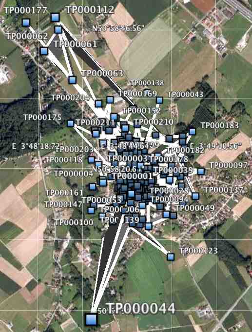
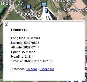
Pigeontrack supplies the data as a KML-file which is directly available after download. This KML-file can be uploaded in Google Earth and contains all the information that Google Earth needs to visualize the path and the tracking points. Each points displays the following information:
- Height, latitude and longitude
- Velocity (in feet)
- Time stamp
|
Photo 1: Google Earth screenshot of a PigeonTrack KML file |
A PigeonTrack KML-file is illustrated in photo 1. In this example, their is a half minute time interval between each point. The points are connected by a line which represents the path. With an interval of half a minute, the track does however not reflect the exact path the pigeons have traveled: tipplers fly in circles and points are connected by a straight line. Each point is identified by a number. By clicking on a point, Google Earth displays a property sheet with the characteristics of each point, as illustrated in photo 2. |
TechnoSmArt (Italian company) delivers the data in different formats.
First of all the data are downloaded as a flat text file with primitive GPS-data, saved according to the NMEA-format; these data are quite cumbersome to analyse and knowledge on GPS data storage is a prerequisite.
These basic data can then be converted by the TechnoSmArt software to a KML-format for Google Earth.
Finally, the TechnoSmArt software can convert the data to a text-file, which can be easily imported in a spreadsheet for further analysis.
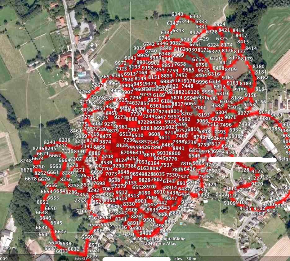
The output of the TechnoSmArt software is illustrated in photo 3.
|
Each numbered point represents a fix (measurement) as illustrated in photo 4
|
These first examples also illustrate the problems encountered with highflyer recordings: tipplers make big circles around the loft while racing pigeons fly from point A to B in a line which never overlaps. Path analysis becomes difficult as the number of fixes is very dense close to the loft and paths superpose each other in time. Further away from the loft, where the birds rarely come, the route is still very clear.
Attaching the device to the pigeon
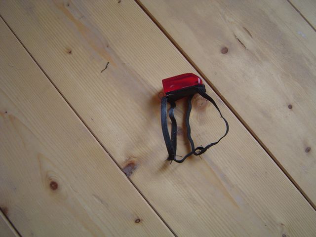
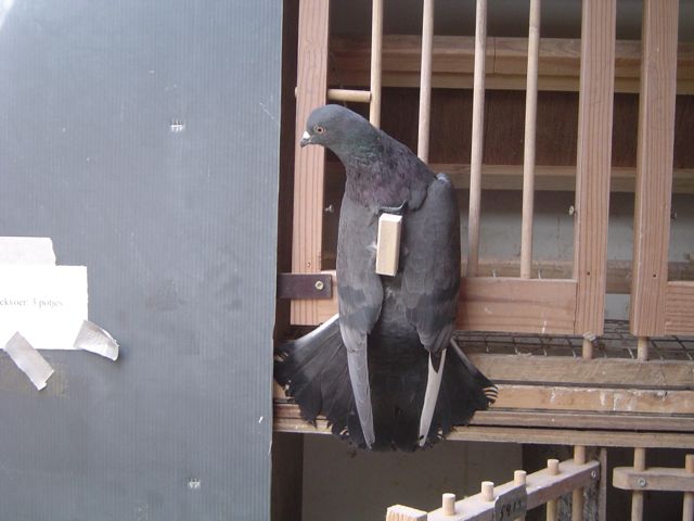
Based on the notes of the suppliers, there are two methods to mount the device on the back of the pigeon. The gps-logger of Pigeontrack comes with a harness as illustrated in ( photo 5). The harness has a velcro which is attached to a flexible strip. It is fixed on the body like a rucksack, holding the velcro slip securily on the back of the pigeon. In the loft the pigeon carries a dummy device with the same dimensions and weight as the real thing. After a week, the pigeon can be released with the real gps-logger. I tested this method with some tipplers. The pigeons seemed very comfortable with the harness and never give it any attention. But in the air, the bird abandoned the flock after some hours indicating that this was not an ideal situation. This happened several times.
The second method is described by TechnoSmArt and is more complicated. On the back of the bird, over an area of 3 cm by 5 cm the feathers are cut to 1 cm of their base. They are cut in a way that the skin remains covered by the feathers; a velcro strip with the same dimensions is then glued to the feathers using a leather glue. Cutting the feathers short gives a good stable support for the velcro. Needless to say that this support has to be checked each time the device is attached but I never had any problems with it; when moulting the feathers regrow. TechnoSmArt advises not to use glue based on cyano-acrylate.
Analysis of the data
It is not easy to analyze the data which come in the original format (*.nme of *.nmea). Some knowledge on the storage of gps-data is welcome.
GPS time recordings come in UTC-time (Coordinated Uiversal Time); This time needs to be converted to the local time, taking into account summer-and winter-time.
Height is indicated in meters (TechnoSmArt), but a correction is needed. Height measurements are done in relation to a "geoid" which represent the hypothetical sea-level. According Google Earth my loft is 30 m above sea-level. However the device reports 70 m. I don't know how this exactly works, but I simply take this 70 m recording as zero height.
A GPS-fix is expressed in radials (longitude and latitude). The distance between two gps-fixes is done with the "Haversine formula". By making the sum of all these distances we have the total distance traveled. In addition to this, the distance of each fix is calculated with regard to the loft.

